Voter Information Lists
Statewide Voter Lists or Voter Lists that Span Multiple Counties
Any person may obtain an electronic copy of a statewide or less than statewide voter list from the Secretary of State Elections Division or any county elections official. The State Elections Division does not provide hardcopy voter lists; requests for hardcopy lists must be made with the county elections official of each county in which voters to be listed reside.
Orders can be placed with the State Elections Division online, and paid for with a check or credit card, via the request for voter list website. Call the State Elections Division at 503-986-1518 with any questions.
The State Elections Division and your County Elections office use the same fee schedule for voter lists.
Multnomah County Voter Lists
Multnomah County can only provide voter lists with data related to Multnomah County voters. If an electoral district is in more than one county, a voter list can be ordered through the State Elections Division or separately through each county that has voters in the district.
Voter lists frequently requested from the Multnomah County Elections Division include:
- Voter Registration List
Includes names, addresses, and party registrations of currently registered voters, listed in computer generated order. Upon request, can include the history of elections in which voters cast ballots. - Walking List
Includes names, addresses, and party registrations of currently registered voters, listed in precinct walking order. - Voted/Not Voted List
Includes names, addresses, and party registrations of currently registered voters and whether or not their ballots have been received in an active election. - Ballot Challenge List
Includes the names and addresses of voters whose ballots have been challenged because they were returned in unsigned ballot envelopes or the signature does not match the voter registration record (only available starting the 15th day after Election Day) - Precinct Committee List
List of names of precinct committee persons by precinct and party.
Some historical elections data can be found on our Results and History page at no cost.
You can order a voter list from Multnomah County Elections through the Multnomah County Public Records Center, following these steps:
- In the Public Records Center, choose "Submit a Records Request"
- From the list of Departments, select the Elections Division
- Log in; if you are a new requester, create an account using a valid email address
- Under the "Record Type" dropdown choose "Voter List"
- Select the criteria for your voter list
- Submit your request
Voter list fee schedule:
- $25 flat fee per list, plus
- $0.025 per 100 voter records included in the list
- There is a $5.00 minimum and $500.00 maximum on order fees
After your order is processed, the Elections Division will send you an invoice with the cost of the voter list and payment instructions. Payment can be made by cash, check, or credit/debit card and must be received before the voter list will be delivered.
Paper data order forms and instructions are available upon request. Call 503-988-VOTE (8683) with questions.
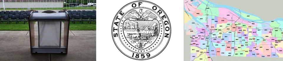
Precinct and District Maps & Data
Interactive online precinct map
Last updated March 2024
GIS Shape Files
Last updated April 2024
Multnomah_Elections_Precinct_Split_2024 (zip, 811 KB)
Precinct and District Maps
- Precincts and Districts
- Precinct Maps by State Representative District and Individual Precincts
- Congressional and Legislative district maps
- Documentmultco_district_1_precincts_map_2024 (325.89 KB)
- Documentmultco_district_2_precincts_map_2024 (2.07 MB)
- Documentmultco_district_3_precincts_map_2023 (1.44 MB)
- Documentmultco_district_4_precincts_map_2024 (1.84 MB)
Portland Council District GIS Shape Files (zip file, 59 KB)
- Document
- Documentportland_district_1_precincts_map_2024 (2.09 MB)
- Documentportland_district_2_precincts_map_2024 (1.84 MB)
- Documentportland_district_3_precincts_map_2024 (1.67 MB)
- Documentportland_district_4_precincts_map_2024 (2.47 MB)
- Documentgresham_precincts_map_2024 (1.74 MB)
- Portland School District zones
- Gresham-Barlow School District zones,
- DocumentCentennial School District Board Zones (1.91 MB)
District and Precinct Data
Voter registration reports from Oregon Central Voter Registration (OCVR) system. For monthly registration statistics, please contact the Oregon Secretary of State. The Secretary of State's office is tasked with collecting monthly statistics for State and Federal requirements.
- DocumentDistrict Voter Count_updated - 4/11/2026.pdf (53.37 KB)
- Document
- DocumentPrecinct Voter Count_updated - 4/11/2026.pdf (43.85 KB)
- Document
- Document
- Document
- Document
Redistricting Information
Information on redistricting after the 2020 Census.
Redistricting Directive (PDF)
Oregon Redistricting - Congressional and Legislative districts.
GIS Shape Files - updated March 2022, after redistricting.
- DocumentPrecinct Shape Files - Multnomah County (792.71 KB)
Maps for County Commission and Metro boundaries
- Document
- Metro Council boundaries 2021
Historical Information
Historical precinct and district data. Information prior to 2011 can be found by visiting County Archives.
GIS data - available to download - last updated Feb 2016
- DocumentGIS precinct data (shape files) - updated 2-2016 (501.02 KB)
- Document
Precinct GIS data prior to 2011 redistricting - updated 2009
- DocumentPrecinct Shape Files (524.66 KB)
Precinct maps - last updated Feb 2016
- DocumentPrecincts in Multnomah County - updated 2-2016 (504.54 KB)
- Precincts by State Representative District - updated 2-2016
- Individual Precincts
- Precinct changes - Feb. 2016 - consolidation of precincts
District maps (2012-2022)
- Federal - 2012
- DocumentUS Congressional Districts in Multnomah County (521.59 KB)
- State - 2012
- DocumentOregon House and Senate Districts - 2011 (612.02 KB)
- County - 2012
- DocumentMultnomah County Commission Districts - 2011 (218.55 KB)
- Metro - 2012
- Metro Council Districts (Metro website - www.oregonmetro.gov)
- Special Districts - 2013-2022
- DocumentSpecial District Shape Files (247.95 KB)
- DocumentMESD Zones 2012 (209.91 KB)
- DocumentMt Hood Community College Board Zones (230.29 KB)
- DocumentPortland Community College Board Zones - 2011 (211.75 KB)
- DocumentFire District Boundaries (615.88 KB)
- DocumentWater District Boundaries (263.97 KB)
- People's Utility Districts - 2012-2022
- DocumentColumbia River PUD (61.03 KB)
- Rockwood PUD
- DocumentInterlachen PUD Sub districts (230.4 KB)
- Oregon Approved Congressional Boundaries 2011
- DocumentUS Congressional Districts in Multnomah County (521.59 KB)
- State of Oregon Redistricting Information (PDF)
Redistricting information from the Oregon Legislature. - Multnomah County Redistricting
Information on the redistricting process for Multnomah County Commissioner Districts
Historical Precinct Maps
Historical Precinct Changes - list of precinct changes from 2011 - 2020.
- 2016 Precinct Consolidation
- DocumentPrecinct Changes after 2011 Redistricting (53.29 KB)
- DocumentPrecinct Changes after 2011 Redistricting (578.35 KB)
- Document
- Document